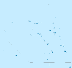
Bikar
Coordenadas: 12° 14' N 170° 8' E
| Bikar | |
|---|---|
 | |
  Bikar | |
| Coordenadas: 12° 14' N 170° 8' E | |
| Geografia física | |
| Arquipélago | Cadeia Ratak |
| Ponto culminante | 6 m |
| Área | 0,5 km² |
| Geografia humana | |
| População | 0 |
| Densidade | 0 hab./km² |
Bikar é um atol desabitado na Cadeia Ratak das Ilhas Marshall. É um dos menores atóis das Ilhas Marshall e está localizado em 12°14'N 170°8'E. Devido ao seu relativo isolamento das ilhas principais do grupo, Bikar tem uma flora e fauna em grande parte intacta que subsiste em condição relativamente intocada.
Geografia
Está localizado a 10 km a norte do atol Majuro, a capital das Ilhas Marshall, 320 km de Bokak a sul-sudeste, e 115 km a norte de Utirik, o atol mais próximo habitado. A sua área é de 0,5 km², em torno de uma lagoa de 37,4 km ². É constituído por 6 ilhas.
Clima
Bikar é um dos mais secos atóis das Ilhas Marshall, tendo um caráter semi-árido. A temperatura média anual é de aproximadamente 28 °C. A precipitação média anual é inferior a 45 polegadas, e cai principalmente durante os meses de julho a outubro. Os ventos Predominantes são de norte e nordeste.
Referências
- Spennemann, Dirk H.R. (2000). «Marshall Islands Atoll Information, Bikar». Digital Micronesia. Albury NSW 2640, Australia: Institute of Land, Water and Society, Charles Sturt University. Consultado em 26 de abril de 2009
- «2008 World Database on Protected Areas». United Nations Environment Programme (UNEP), World Conservation Monitoring Centre. 25 de abril de 2009
- «USDA Plants Database». USDA Natural Resources Conservation Service
- Dieter Mueller-Dombois, Francis Raymond Fosberg (1998). Vegetation of the Tropical Pacific Islands. [S.l.]: Springer. p. 306. ISBN 0387983139 !CS1 manut: Usa parâmetro autores (link)
- Spennemann, Dirk H.R. (2000). «Stormy Years: On the Association between the El Niño phenomenon and the occurrence of typhoons in the Marshall Islands». Digital Micronesia. Albury NSW 2640, Australia: Institute of Land, Water and Society, Charles Sturt University. Consultado em 26 de abril de 2009
- «Atoll Research Bulletin No. 260». 1983
- «Bikar Atoll». The Island Encyclopedia. oceandots.com. Consultado em 27 de maio de 2009
- «Atoll Research Bulletin No. 11, Land Tenure in the Marshall Islands». Smithsonian National Museum of Natural History. 1 de setembro de 1952
- Adelbert von Chamisso, translated by Henry Kratz (1986). A voyage around the world with the Romanzov exploring expedition in the years 1815-1818 in the brig Rurik, Captain Otto von Kotzebue. [S.l.]: University of Hawaii Press. p. 157. ISBN 0824809831 !CS1 manut: Usa parâmetro autores (link)
- Spennemann, Dirk H.R. (2000). «Ships visiting the Marshall Islands (until 1885)». Digital Micronesia. Albury NSW 2640, Australia: Institute of Land, Water and Society, Charles Sturt University. Consultado em 26 de abril de 2009
- De Rosamel, Capitaine De Corvette Joseph. Pohnpei, Micronésie, en 1840 : voyage de circumnavigation de la Danaïde. [S.l.: s.n.] ISBN 2854300092
- Spennemann, Dirk H.R. (2000). «Foreign Land holdings in the German Marshall Islands». Digital Micronesia. Albury NSW 2640, Australia: Institute of Land, Water and Society, Charles Sturt University. Consultado em 26 de abril de 2009
- «Grim Signs Of Shipwreck». The Republican. Estherville, IA, USA: Jenkins & Nichols. Japan Daily Mail. 7 de novembro de 1901. p. 1. Consultado em 25 de abril de 2009.
News comes from Australia of the finding on Bikar island, a small uninhabited atoll of the Marshall group, of wreckage which is thought to indicate that the British ship Manchester came to grief there.
- «Expedition Will Explore 'Robinson Crusoe' Islands». Herald-American. Syracuse, NY, USA. NANA. 25 de novembro de 1951. p. 8. Consultado em 26 de abril de 2009
- «Reports On Evacuation Of Natives And Surveys Of Several Marshall Island Atolls» (PDF). Department of Health, Safety, and Security , DOE. 24 de maio de 1954
- «Northern Marshall Island Rad Survey: Radionuclide Concentrations in Fish and Clams and Estimated Doses via the Marine Pathway». Department of Health, Safety, and Security , DOE. 18 de agosto de 1981
- " «Boat Missing». Free Press. Winnipeg: Clifford Sifton. AP. 5 de fevereiro de 1962. p. 9. Consultado em 26 de abril de 2009.
A U.S. Navy plane sighted 19 Japanese fishermen on Bikar Island in the Marshall Islands Sunday.
- «Earthwatch». The Intelligencer, Doylestown, PA, May 2, 1993
- «LST 1138 aka USS STEUBEN COUNTY, Years 1952-1955». C.D. Pardee. 11 de julho de 2007
- Ben M. Cahoon. «WorldStatesmen.org, Marshall Islands»
Ligações externas
- «UNEP Protected Areas Program Profile»
- «Atoll Research Bulletin Archive Home Page»
- «U.S. Dept. of Energy OPENnet advanced search page»
- «Plants in the Marshall Islands, A Photo Essay»
- «Sailing Ship: Manchester (1892-1900)»
- «Miramar Ship Index: Manchester»


