Sollières-Sardières
You can help expand this article with text translated from the corresponding article in French. (August 2022) Click [show] for important translation instructions.
- Machine translation, like DeepL or Google Translate, is a useful starting point for translations, but translators must revise errors as necessary and confirm that the translation is accurate, rather than simply copy-pasting machine-translated text into the English Wikipedia.
- Do not translate text that appears unreliable or low-quality. If possible, verify the text with references provided in the foreign-language article.
- You must provide copyright attribution in the edit summary accompanying your translation by providing an interlanguage link to the source of your translation. A model attribution edit summary is
Content in this edit is translated from the existing French Wikipedia article at [[:fr:Sollières-Sardières]]; see its history for attribution. - You may also add the template
{{Translated|fr|Sollières-Sardières}}to the talk page. - For more guidance, see Wikipedia:Translation.
Part of Val-Cenis in Auvergne-Rhône-Alpes, France
Sollières-Sardières | |
|---|---|
Part of Val-Cenis | |
 View from Sardières towards Sollières | |
Location of Sollières-Sardières  | |
45°15′54″N 6°48′33″E / 45.265°N 6.8092°E / 45.265; 6.8092 | |
| Country | France |
| Region | Auvergne-Rhône-Alpes |
| Department | Savoie |
| Arrondissement | Saint-Jean-de-Maurienne |
| Canton | Modane |
| Commune | Val-Cenis |
| Area 1 | 33.31 km2 (12.86 sq mi) |
| Population (2019)[1] | 170 |
| • Density | 5.1/km2 (13/sq mi) |
| Time zone | UTC+01:00 (CET) |
| • Summer (DST) | UTC+02:00 (CEST) |
| Postal code | 73500 |
| Elevation | 1,232–3,241 m (4,042–10,633 ft) (avg. 1,270 m or 4,170 ft) |
| 1 French Land Register data, which excludes lakes, ponds, glaciers > 1 km2 (0.386 sq mi or 247 acres) and river estuaries. | |
Sollières-Sardières is a former commune in the Savoie department in the Auvergne-Rhône-Alpes region in south-eastern France. On 1 January 2017, it was merged into the new commune Val-Cenis.[2] It is located the heart of the Alps in the upper Maurienne valley 120 km long.[citation needed] Part of the region is within the Vanoise National Park.[citation needed] The remaining land is not included in the protected area called "zone peripherique" which has lesser environmental protection enforcement rules.[citation needed] Some flowers can only be found in the heights of the commune and in boreal regions.[citation needed] It has a small airstrip ICAO code: LFKD[citation needed]
- Villages and landscapes
-
 The village of Sardières in winter
 -
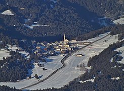
 The village of Sollières
 -
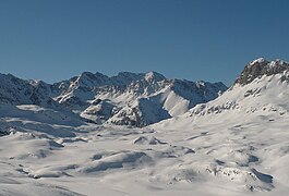
 The commune lies at the limit of the Vanoise National Park
 -
 The Dent Parrachée
 -
 Petit Mont Cenis Pass
 -
 Monolithe of Sardières (93 m)
 -
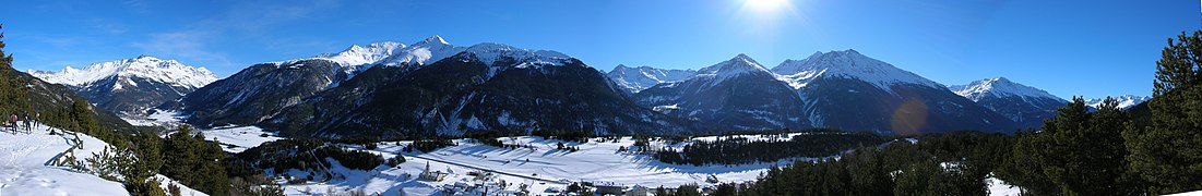 Panoramic view of the massifs of Mont Cenis and Ambin


See also
References
Wikimedia Commons has media related to Sollières-Sardières.
Authority control databases | |
|---|---|
| International |
|
| National |
|
- v
- t
- e


