Rural Municipality of Lakeshore
Rural municipality in Manitoba, Canada
Rural municipality in Manitoba, Canada
51°14′38″N 99°39′22″W / 51.243962°N 99.656216°W / 51.243962; -99.656216(amalgamated)
(2021)
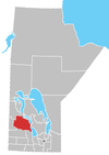
The Rural Municipality of Lakeshore is a rural municipality (RM) in the Parkland Region of Manitoba, Canada.
Lakeshore is named for the proximity of the shoreline of Dauphin Lake, which splits the municipality into north and south.[3] The RM is anchored on its south end by the Rainbow Beach Provincial Park on Dauphin Lake, and on its north end by Manipogo Provincial Park on Lake Manitoba.[4]
History
The RM was incorporated on January 1, 2015 via the amalgamation of the RMs of Ochre River and Lawrence.[1] It was formed as a requirement of The Municipal Amalgamations Act, which required that municipalities with a population less than 1,000 amalgamate with one or more neighbouring municipalities by 2015.[5] The Government of Manitoba initiated these amalgamations in order for municipalities to meet the 1997 minimum population requirement of 1,000 to incorporate a municipality.[6]
Communities
Constituent communities of the Rural Municipality of Lakeshore include:[3]
- East Bay
- Freedale
- Magnet
- Makinak
- Methley
- Million
- Moose Bay
- Toutes Aides
- Weiden
Demographics
In the 2021 Census of Population conducted by Statistics Canada, Lakeshore had a population of 1,186 living in 531 of its 861 total private dwellings, a change of -13% from its 2016 population of 1,363. With a land area of 1,295.64 km2 (500.25 sq mi), it had a population density of 0.9/km2 (2.4/sq mi) in 2021.[7]
See also
References
- ^ a b "The Municipal Amalgamations Act (C.C.S.M. c. M235): Rural Municipality of Ochre River and Rural Municipality of Lawrence Amalgamation Regulation" (PDF). Government of Manitoba. Retrieved October 4, 2014.
- ^ "Reeve & Councillors." rmoflakeshore.ca. Retrieved 2021-08-04.
- ^ a b "Manitoba Communities: Lakeshore (Rural Municipality)". www.mhs.mb.ca. Retrieved August 5, 2021.
- ^ "Welcome | Rural Municipality of Lakeshore | Home". www.rmoflakeshore.ca. Retrieved August 5, 2021.
- ^ "The Municipal Amalgamations Act (C.C.S.M. c. M235)". Government of Manitoba. October 2, 2014. Retrieved October 4, 2014.
- ^ "Speech from the Throne: At the Opening of the Second Session of the 40th Legislature of the Province of Manitoba". Government of Manitoba. November 19, 2012. Retrieved October 4, 2014.
- ^ "Population and dwelling counts: Canada, provinces and territories, and census subdivisions (municipalities), Manitoba". Statistics Canada. February 9, 2022. Retrieved February 20, 2022.
Places adjacent to Rural Municipality of Lakeshore | ||||||||||||||||
|---|---|---|---|---|---|---|---|---|---|---|---|---|---|---|---|---|
| ||||||||||||||||


- v
- t
- e
| Former towns |
|---|
| Former villages |
|---|
| Former RMs |
|---|
- Ebb and Flow
- Keeseekoowenin (Partly)
- Alonsa
- Amaranth
- Ashville
- Bacon Ridge
- Bluff Creek
- Cayer
- East Bay
- Eddystone
- Fork River
- Freedale
- Garland
- Glencairn
- Halicz
- Harcus
- Keld
- Kinosota
- Laurier
- Lonely Lake
- Magnet
- Makinak
- Manitoba House
- Meharry
- Million
- Mink Creek
- Moore Dale
- Moose Bay
- Norgate
- North Junction
- Oak Brae
- Ochre River
- Paulson
- Portia
- Reedy Creek
- Reeve
- Reykjavik
- Rorketon
- Ste. Amélie
- Shergrove
- Sifton
- Silver Ridge
- Toutes Aides
- Trembowla
- Valley River
- Valpoy
- Venlaw
- Volga
- Weiden
- Zoria

51°14′38″N 99°39′22″W / 51.243962°N 99.656216°W / 51.243962; -99.656216


