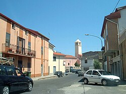
Lula, Sardinia
Comune in Sardinia, Italy
Lula Lùvula | |
|---|---|
Comune | |
| Comune di Lula | |
 Lula | |
Location of Lula  | |
40°28′N 9°29′E / 40.467°N 9.483°E / 40.467; 9.483 | |
| Country | Italy |
| Region | Sardinia |
| Province | Nuoro (NU) |
| Government | |
| • Mayor | Mario Calia |
| Area | |
| • Total | 148.72 km2 (57.42 sq mi) |
| Elevation | 521 m (1,709 ft) |
| Population (28 February 2017)[2] | |
| • Total | 1,395 |
| • Density | 9.4/km2 (24/sq mi) |
| Demonym | Lulesi |
| Time zone | UTC+1 (CET) |
| • Summer (DST) | UTC+2 (CEST) |
| Postal code | 08020 |
| Dialing code | 0784 |
| Website | Official website |
Lula (Sardinian: Lùvula) is a comune (municipality) in the Province of Nuoro in the Italian region Sardinia, located about 220 kilometres (140 mi) north of the regional capital Cagliari and about 40 kilometres (25 mi) northeast of the provincial capital Nuoro.
Lula is located on the bottom of Mount Albo, a chain of white limestone, with numerous natural caves and stalactites.
Lula borders the following municipalities: Bitti, Dorgali, Galtellì, Irgoli, Loculi, Lodè, Onanì, Orune, Siniscola.

References
Wikimedia Commons has media related to Lula (Italy).
- v
- t
- e
- Aritzo
- Arzana
- Atzara
- Austis
- Bari Sardo
- Baunei
- Belvì
- Birori
- Bitti
- Bolotana
- Borore
- Bortigali
- Cardedu
- Desulo
- Dorgali
- Dualchi
- Elini
- Fonni
- Gadoni
- Gairo
- Galtellì
- Gavoi
- Girasole
- Ilbono
- Irgoli
- Jerzu
- Lanusei
- Lei
- Loceri
- Loculi
- Lodè
- Lodine
- Lotzorai
- Lula
- Macomer
- Mamoiada
- Meana Sardo
- Noragugume
- Nuoro
- Oliena
- Ollolai
- Olzai
- Onanì
- Onifai
- Oniferi
- Orani
- Orgosolo
- Orosei
- Orotelli
- Ortueri
- Orune
- Osidda
- Osini
- Ottana
- Ovodda
- Perdasdefogu
- Posada
- Sarule
- Silanus
- Sindia
- Siniscola
- Sorgono
- Talana
- Tertenia
- Teti
- Tiana
- Tonara
- Torpè
- Tortolì
- Triei
- Ulassai
- Urzulei
- Ussassai
- Villagrande Strisaili
Authority control databases | |
|---|---|
| International |
|
| National |
|
 | This Sardinia location article is a stub. You can help Wikipedia by expanding it. |
- v
- t
- e


