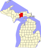
Germfask Township, Michigan
Civil township in Michigan, United States
46°14′49″N 85°56′22″W / 46.24694°N 85.93944°W / 46.24694; -85.93944 (2020)
49836 (Germfask)
49853 (McMillan)
49853 (McMillan)
Germfask Township is a civil township of Schoolcraft County in the U.S. state of Michigan. The population was 469 in 2020.[3]
The name was derived from the surname initials of eight of the original settlers of 1881: John Grant, Matthew Edge, William Robinson, Thaddeus Mead, Dr. W. W. French, Ezekiel Ackley, Oscar (O.D.) Sheppard, and Hezekiah Knaggs.[4] The community was a station on the Manistique Railway and was given a post office on February 26, 1890.[5]
Geography
According to the United States Census Bureau, the township has a total area of 71.63 square miles (185.52 km2), of which 66.43 square miles (172.05 km2) is land and 5.20 square miles (13.47 km2) (7.26%) is water.
Communities
- Germfask is an unincorporated community located in the northern part of the township where the Manistique River crosses M-77 on the eastern edge of the Seney National Wildlife Refuge at 46°14′58″N 85°55′33″W / 46.24944°N 85.92583°W / 46.24944; -85.92583.[6] The Germfask 49836 ZIP Code serves most of the township.
References
- ^ "U.S. Census website". United States Census Bureau. Retrieved January 31, 2008.
- ^ U.S. Geological Survey Geographic Names Information System: Germfask Township, Michigan
- ^ "Explore Census Data". data.census.gov. Retrieved August 4, 2023.
- ^ Pike, Vicki Lustila (July 26, 1973). Germfask, Michigan: Its Pioneers and Development. self-published.
- ^ Romig, Walter, L.H.D. (1986). Michigan Place Names. Detroit: Wayne State University Press. ISBN 0-8143-1838-X.
{{cite book}}: CS1 maint: multiple names: authors list (link) - ^ U.S. Geological Survey Geographic Names Information System: Germfask, Michigan
- v
- t
- e
Municipalities and communities of Schoolcraft County, Michigan, United States
County seat: Manistique
communities
‡This populated place also has portions in an adjacent county or counties
- Michigan portal
- United States portal
| Authority control databases |
|
|---|


