Ellerhoop
German municipality twinned with Hurst Green, UK
Municipality in Schleswig-Holstein, Germany

Coat of arms
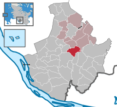
Location of Ellerhoop within Pinneberg district
53°43′39″N 9°46′14″E / 53.72750°N 9.77056°E / 53.72750; 9.77056
(2022-12-31)[1]
25373
Ellerhoop is a municipality in the district of Pinneberg in Schleswig Holstein, Germany. It is twinned with the village of Hurst Green, East Sussex, UK.
Geography
Ellerhoop is situated to the north of Hamburg, close to the A23 Autobahn.
Points of interest
References
- ^ "Bevölkerung der Gemeinden in Schleswig-Holstein 4. Quartal 2022" (XLS) (in German). Statistisches Amt für Hamburg und Schleswig-Holstein.
- v
- t
- e
Towns and municipalities in Pinneberg (district)
- Appen
- Barmstedt
- Bevern
- Bilsen
- Bokel
- Bokholt-Hanredder
- Bönningstedt
- Borstel-Hohenraden
- Brande-Hörnerkirchen
- Bullenkuhlen
- Ellerbek
- Ellerhoop
- Elmshorn
- Groß Nordende
- Groß Offenseth-Aspern
- Halstenbek
- Haselau
- Haseldorf
- Hasloh
- Heede
- Heidgraben
- Heist
- Heligoland
- Hemdingen
- Hetlingen
- Holm
- Klein Nordende
- Klein Offenseth-Sparrieshoop
- Kölln-Reisiek
- Kummerfeld
- Langeln
- Lutzhorn
- Moorrege
- Neuendeich
- Osterhorn
- Pinneberg
- Prisdorf
- Quickborn
- Raa-Besenbek
- Rellingen
- Schenefeld
- Seester
- Seestermühe
- Seeth-Ekholt
- Tangstedt
- Tornesch
- Uetersen
- Wedel
- Westerhorn

Authority control databases | |
|---|---|
| International |
|
| National |
|
 | This Pinneberg district location article is a stub. You can help Wikipedia by expanding it. |
- v
- t
- e


