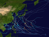
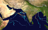
Cyclone Matmo–Bulbul is the unofficial collective designation given to both Severe Tropical Storm Matmo[a] and Very Severe Cyclonic Storm Bulbul[b] (/ˈbʊlbʊl/) (JTWC designation: 23W), which were a pair of destructive tropical cyclones that tracked in the Western Pacific Ocean and the North Indian Ocean in October and November 2019 respectively, killing 43 people and inflicting about US$3.537 billion in damage. Matmo was the 41st tropical depression and the 22nd named storm of the 2019 Pacific typhoon season, while Bulbul was the 9th depression and the 7th named storm of the 2019 North Indian Ocean cyclone season. The cyclone formed on October 28 in the South China Sea and intensified into Tropical Storm Matmo, as named by the Japan Meteorological Agency (JMA). On October 30, the storm made landfall in central Vietnam, causing flooding. Matmo weakened while moving westward across Mainland Southeast Asia, before degenerating into a remnant low later that day. The remnants of Matmo emerged into the Bay of Bengal, redeveloping into a depression on November 5. Late the next day, it strengthened into a cyclonic storm, renamed Bulbul by the India Meteorological Department (IMD), although the JTWC continued to refer to it as Matmo. The storm peaked on November 8, with maximum sustained winds 140 km/h (85 mph) estimated by the IMD. On November 9, the cyclone made its final landfall in the eastern Indian state of West Bengal, and around that time the storm turned to the northeast, moving into Bangladesh. The system degenerated into a remnant low two days later, over northeastern India.
In India and Bangladesh, the storm caused storm surge, heavy rains, and flash floods.[1][2][3] In addition, it is only the second storm to reach hurricane-equivalent strength in the Bay of Bengal after moving over Mainland Southeast Asia, the first being another cyclone in October 1960.[4]
On October 28, a tropical depression formed near Palau, which was named Matmo by the Japan Meteorological Agency (JMA) on October 30. It quickly intensified into a severe tropical storm, packing 10-minute sustained winds up to 60 mph (95 km/h), as it approached the Vietnamese coast. A quick moving storm, Matmo made landfall in Vietnam on the same day, bringing strong winds and heavy rain, causing moderate flooding and many road closures in the country.[5] Not long after landfall in Vietnam, it weakened into a tropical depression, later degenerating into a remnant low as its low-level circulation dissipated.[6]
Severe Tropical Storm Matmo's remnant re-organizing over the Andaman Sea on November 4, 2019.
On November 2, the remnants of Matmo emerged into the northern Andaman Sea.[7] Meteorological agencies began to show interest in the system, as it slowly began to reorganize and develop, with the storm developing a new low-level circulation on November 4.[6] It then fully reformed into a depression on November 5.[6] Upon strengthening into a cyclonic storm, the India Meteorological Department (IMD) assigned the name Bulbul. It continued intensifying and strengthening for the next three days; however, the storm still slowly moving northward, prompting the IMD to issue coastal warnings for Bangladesh and West Bengal of India, in addition to prohibiting all fishermen activity, beach activity, and boating in and around the Bay of Bengal. About a day later, Bulbul made landfall near Sagar Island in West Bengal, around 18:30 GMT on November 9, killing at least two people and weakening back to a Severe Cyclonic Storm, as it interacted with land and unleashed a high storm surge.[8] Not too long after this land interaction, Bulbul rapidly weakened into a deep depression on the next day, as it began to move over Bangladesh; however, the storm still continued to cause very heavy rain, before weakening into a well-marked low on November 11.[9]
Preparations
Bangladesh
Ahead of Bulbul's landfall, Bangladeshi officials ordered 2.1 million people to evacuate coastal areas.[10] Due to the cyclone, all the JSC–JDC examinations on November 9, 11, and 12, and the National University examination on November 9 were suspended.[11][12][13]Bangladesh Inland Water Transport Authority suspended all sorts of activities at three maritime ports and riverine transport services during the cyclone.[14] All flights to and from Shah Amanat International Airport in Chittagong and Cox's Bazar, Barisal, Jashore domestic airports were cancelled for 14 hours owing to the inclement weather under the influence of the cyclone.[15] Health department officials in these districts formed 1,599 teams to attend to those affected by the cyclone. Around 56,000 volunteers were deployed to conduct rescue and relief efforts while the military bases at the coastal districts remain on alert.[16] All coastal infantries of the Bangladesh Army prepared to take immediate action to provide assistance during and post cyclonic destruction.[17] The Bangladesh Navy and the Bangladesh Coast Guard prepared to undertake emergency rescue and relief operations with warships and vessels.[18]
Impact and aftermath
Vietnam
Matmo destroyed 2,700 houses and 35 schools, causing 3.8 billion VND (US$165 million) in damage in Vietnam, with majority of losses in two provinces: Quảng Ngãi and Bình Định.[19] The storm also killed two people in the country.[20]
Cyclone Bulbul caused severe damage across coastal Bangladesh, resulting in the deaths of 25 people.[21] In the Khulna District, 9,455 homes were destroyed and 37,820 were damaged.[22] Across the Bagerhat District, 8,788 homes were destroyed and 35,779 were damaged.[21] The nation's agriculture industry was severely affected, with 289,006 hectares (714,150 acres) of farmland—roughly 14 percent of the nation's total farmland—was damaged. Approximately 72,000 metric tons of crops were lost, with a total value of Tk 2.68 billion (US$31.6 million).[23]
India
Odisha
In Odisha, the cyclone's outer bands produced heavy rain and squalls, causing agricultural damage, uprooting trees, and knocking down power lines.[24] Although, as part of rescue, around 350 local villagers in the district of Balesore were taken to cyclone shelters as the storm neared.[25] An estimated 200,000 hectares (490,000 acres) of crops were damaged statewide.[26] Two people died in storm-related incidents.[27]
West Bengal
Bulbul's landfall in West Bengal around the Sunderban forest brought extremely heavy rain and winds up to 137 km/h (85 mph) across much of the southern portion of the state.[28] A 59-year-old man was killed after being electrocuted by a lamp post, and another was killed due to a collapsed wall. Before the cyclone even made landfall, however, a man was killed after a cedar tree branch fell on top of him.[29] Fallen trees caused road blockages across the city of Kolkata as well, and members of the Kolkata Municipal Corporation (KMC) removed these blockages. Operations at Netaji Subhas Chandra Bose International Airport in Kolkata were suspended for 12 hours.[30]
Throughout West Bengal, approximately 3.5 million people were directly affected by the cyclone; 14 people died in storm-related incidents. A total of 517,535 homes and 1,489,924 hectares (3,681,680 acres) of crops were damaged or destroyed, with losses reaching Rs 238.11 billion (US$3.34 billion).[31]
West Bengal's Public Health Engineering department distributed 435,000 tarpaulins and 620,000 water containers in the affected areas.[31]
^The name Bulbul was provided by Pakistan which known as the family of birds (Songbird). It is also refers to the 'nightingale' in Urdu.
References
^"Cyclone Bulbul Live: Bulbul Cyclone crosses West Bengal coast". The Times of India. November 10, 2019. Archived from the original on November 10, 2019. Retrieved November 10, 2019.
^Erdman, Jonathan (2019). "Tropical Cyclone Bulbul Targets Eastern India, Bangladesh With Flooding Rain, Storm Surge, Winds". TWC India. TWC India. Archived from the original on November 8, 2019. Retrieved November 9, 2019.
^"Cyclone Bulbul: 5 to 7 feet high storm surge may hit coastal areas". The Daily Star. November 8, 2019. Archived from the original on November 9, 2019. Retrieved November 9, 2019.
^"Tropical Cyclone Matmo is reborn as Bulbul". Aljazeera. November 8, 2019. Archived from the original on November 8, 2019. Retrieved November 9, 2019.
^"Weather Warning "Tropical Storm MATMO, category 3" - No. 7 Time Issued : October 30, 2019 - Thailand". ReliefWeb. October 30, 2019. Archived from the original on November 13, 2019. Retrieved November 13, 2019.
^ abc"Very Severe Cyclonic Storm "BUL BUL" over the Bay of Bengal (05th – 11th November 2019): Summary" (PDF). Regional Specialised Meteorological Centre – Tropical Cyclones, New Delhi. Retrieved May 18, 2020.
^"NASA tracking remnants of Tropical Cyclone Matmo". EukerAlert. November 5, 2019. Archived from the original on November 5, 2019. Retrieved November 5, 2019.
^"Cyclone Bulbul makes landfall amid India and Bangladesh evacuations". BBC News. November 9, 2019. Archived from the original on November 10, 2019. Retrieved November 9, 2019.
^"Deadly Cyclone Bulbul weakens over Bangladesh". Aljazeera. Archived from the original on November 10, 2019. Retrieved November 10, 2019.
^Bangladesh: Cyclone Bulbul – Emergency Plan of Action (EPoA) DREF Operation n° MDRBD023 (PDF) (Report). International Federation of Red Cross And Red Crescent Societies. November 14, 2019. Archived (PDF) from the original on December 9, 2019. Retrieved December 9, 2019 – via ReliefWeb.
^"Cyclone Bulbul forces rescheduling of Saturday's JSC, JDC, National University exams". bdnews24.com. November 8, 2019. Archived from the original on November 8, 2019. Retrieved November 9, 2019.
^"JSC, JDC exams on Nov 11 rescheduled due to cyclone Bulbul". Dhaka Tribune. November 9, 2019. Archived from the original on November 9, 2019. Retrieved November 9, 2019.
^"Cyclone Bulbul: Tuesday's JSC, JDC exams rescheduled". Dhaka Tribune. November 10, 2019. Archived from the original on November 11, 2019. Retrieved November 11, 2019.
^"Bangladesh suspends maritime port operations, water transport as cyclone nears". bdnews24.com. November 9, 2019. Archived from the original on November 8, 2019. Retrieved November 9, 2019.
^"Flights to and from Cox's, Ctg, Barisal, Jashore cancelled for 14hrs for 'Bulbul'". The Daily Star. November 9, 2019. Archived from the original on November 9, 2019. Retrieved November 9, 2019.
^"Cyclone Bulbul to hit Bangladesh coast Saturday night". bdnews24.com. November 9, 2019. Archived from the original on November 9, 2019. Retrieved November 9, 2019.
^"Cyclone Bulbul: Army deploys teams in Satkhira". Dhaka Tribune. November 9, 2019. Archived from the original on November 9, 2019. Retrieved November 9, 2019.
^"Cyclone Bulbul: Naval ships ready for emergency rescue, relief efforts". bdnews24.com. November 9, 2019. Archived from the original on November 9, 2019. Retrieved November 9, 2019.
^Nguyen Bich (December 26, 2019). "Thiệt hại do thiên tai trong năm 2019 giảm kỷ lục". Bienphong (in Vietnamese). Retrieved October 3, 2021.
^TỔNG HỢP THIỆT HẠI DO THIÊN TAI NĂM 2019 (PDF) (Report) (in Vietnamese). Government of Vietnam. July 1, 2020. Retrieved October 3, 2021.
^ ab"25 killed as cyclone Bulbul ravages coastal districts". The Independent. November 12, 2019. Archived from the original on December 9, 2019. Retrieved December 9, 2019.
^"Cyclone 'Bulbul' destroys 9,455 homesteads in Khulna". The Independent. November 11, 2019. Archived from the original on December 9, 2019. Retrieved December 9, 2019.
^"Tk 268 cr damage in agriculture caused by Cyclone 'Bulbul'". Daily Bangladesh. November 12, 2019. Retrieved December 9, 2019.
^"Cyclone Bulbul kills man in Kolkata, brings heavy rain to Odisha". Times of India. November 9, 2019. Archived from the original on November 10, 2019. Retrieved November 10, 2019.
^"Cyclone 'Bulbul': Around 350 people take shelter at Baleswar district in Odisha". Deccan Chronicle. November 10, 2019. Archived from the original on November 10, 2019. Retrieved November 10, 2019.
^"Cyclone Bulbul: Power services in affected areas of Odisha, West Bengal restored". India Today. Press Trust of India. November 11, 2019. Archived from the original on November 12, 2019. Retrieved December 9, 2019.
^'Bulbul' claims 2 lives in Odisha, extensive damage to crops (Report). Government of India. November 10, 2019. Archived from the original on November 20, 2019. Retrieved December 9, 2019 – via ReliefWeb.
^"Cyclone Bulbul kills 10 in West Bengal, 2.73 lakh families affected in the state". Times of India. November 10, 2019. Archived from the original on November 10, 2019. Retrieved November 10, 2019.
^"Cyclone Bulbul: 7 killed, normal life disrupted in West Bengal". liveMint. November 10, 2019. Archived from the original on November 10, 2019. Retrieved November 10, 2019.
^"Cyclone 'Bulbul': Operations at Kolkata airport suspended for 12 hrs". The Daily Star. November 9, 2019. Archived from the original on November 9, 2019. Retrieved November 9, 2019.
^ ab"Cyclone Bulbul caused Rs 23,811 crore losses: West Bengal Government". India Today. Press Trust of India. November 17, 2019. Archived from the original on November 17, 2019. Retrieved December 9, 2019.
External links
Wikimedia Commons has media related to Cyclone Matmo–Bulbul.


 Extratropical cyclone, remnant low, tropical disturbance, or monsoon depression