Cagle, Tennessee
Unincorporated community in Tennessee, US

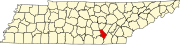
Cagle (also known as Cagle Mountain) is an unincorporated community in Sequatchie County, Tennessee, United States.[1] It is concentrated around the intersection of Tennessee State Route 111 and Tennessee State Route 399 atop the Cumberland Plateau in the western part of the county. Its elevation is 2,106 feet (642 m).[1] The Tennessee Valley Divide passes through the community.
Cagle was originally known as "Mount Pleasant" after a Methodist church established in the area in the 1840s. When a post office was established in the community 1880, it was named "Cagle" after a family of early settlers.[2]
Cagle is home to a community center, fire department, and several small businesses.[3]
References
- ^ a b U.S. Geological Survey Geographic Names Information System: Cagle, Tennessee
- ^ Henry R. Camp, Robert B. Jones (ed.), Tennessee County History Series: Sequatchie County (Memphis State University Press, 1984), p. 110.
- ^ Ben Benton, "Cagle Fire Hall Project Resumes in Sequatchie County," Chattanooga Times Free Press, 1 April 2014.
- v
- t
- e
Municipalities and communities of Sequatchie County, Tennessee, United States
County seat: Dunlap
- Dunlap
- Lone Oak
communities
- Brush Creek
- Cagle
- Lewis Chapel
- Tennessee portal
- United States portal
35°28′30″N 85°27′39″W / 35.47500°N 85.46083°W / 35.47500; -85.46083
 | This Sequatchie County, Tennessee geography–related article is a stub. You can help Wikipedia by expanding it. |
- v
- t
- e


