Bassoues
Commune in Occitania, France

Coat of arms
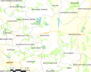
Location of Bassoues

(2020–2026) Claude Gatelet[1]
1
(2021)[2]
32032 /32320
(avg. 220 m or 720 ft)
Bassoues (French pronunciation: [basu]; Occitan: Bassoas) is a commune in the Gers department in southwestern France.
Geography
The Auzoue, a tributary of the Gélise, has its source in the southwestern part of the commune. The Guiroue, another tributary of the Gélise, flows north through the eastern part of the commune. The Barade, a stream, tributary of the Guirou, forms the commune's eastern border.
Population
| Year | Pop. | ±% |
|---|---|---|
| 1962 | 631 | — |
| 1968 | 568 | −10.0% |
| 1975 | 512 | −9.9% |
| 1982 | 503 | −1.8% |
| 1990 | 454 | −9.7% |
| 1999 | 376 | −17.2% |
| 2008 | 391 | +4.0% |
See also
References
- ^ "Répertoire national des élus: les maires". data.gouv.fr, Plateforme ouverte des données publiques françaises (in French). 2 December 2020.
- ^ "Populations légales 2021" (in French). The National Institute of Statistics and Economic Studies. 28 December 2023.
Wikimedia Commons has media related to Bassoues.
- v
- t
- e
Communes of the Gers department 

- Aignan
- Ansan
- Antras
- Arblade-le-Bas
- Arblade-le-Haut
- Ardizas
- Armentieux
- Armous-et-Cau
- Arrouède
- Aubiet
- Auchpref
- Augnax
- Aujan-Mournède
- Auradé
- Aurensan
- Aurimont
- Aussos
- Auterive
- Aux-Aussat
- Avensac
- Avéron-Bergelle
- Avezan
- Ayguetinte
- Ayzieu
- Bajonnette
- Barcelonne-du-Gers
- Barcugnan
- Barran
- Bars
- Bascous
- Bassoues
- Bazian
- Bazugues
- Beaucaire
- Beaumarchés
- Beaumont
- Beaupuy
- Beccas
- Bédéchan
- Bellegarde
- Belloc-Saint-Clamens
- Belmont
- Béraut
- Berdoues
- Bernède
- Berrac
- Betcave-Aguin
- Bétous
- Betplan
- Bézéril
- Bezolles
- Bézues-Bajon
- Biran
- Bivès
- Blanquefort
- Blaziert
- Blousson-Sérian
- Bonas
- Boucagnères
- Boulaur
- Bourrouillan
- Bouzon-Gellenave
- Bretagne-d'Armagnac
- Le Brouilh-Monbert
- Brugnens
- Cabas-Loumassès
- Cadeilhan
- Cadeillan
- Cahuzac-sur-Adour
- Caillavet
- Callian
- Campagne-d'Armagnac
- Cassaigne
- Castelnau-Barbarens
- Castelnau-d'Anglès
- Castelnau-d'Arbieu
- Castelnau-d'Auzan-Labarrère
- Castelnau-sur-l'Auvignon
- Castelnavet
- Castéra-Lectourois
- Castéra-Verduzan
- Castéron
- Castet-Arrouy
- Castex
- Castex-d'Armagnac
- Castillon-Debats
- Castillon-Massas
- Castillon-Savès
- Castin
- Catonvielle
- Caumont
- Caupenne-d'Armagnac
- Caussens
- Cazaubon
- Cazaux-d'Anglès
- Cazaux-Savès
- Cazaux-Villecomtal
- Cazeneuve
- Céran
- Cézan
- Chélan
- Clermont-Pouyguillès
- Clermont-Savès
- Cologne
- Condomsubpr
- Corneillan
- Couloumé-Mondebat
- Courrensan
- Courties
- Crastes
- Cravencères
- Cuélas
- Dému
- Duffort
- Duran
- Durban
- Eauze
- Encausse
- Endoufielle
- Esclassan-Labastide
- Escornebœuf
- Espaon
- Espas
- Estampes
- Estang
- Estipouy
- Estramiac
- Faget-Abbatial
- Flamarens
- Fleurance
- Fourcès
- Frégouville
- Fustérouau
- Galiax
- Garravet
- Gaudonville
- Gaujac
- Gaujan
- Gavarret-sur-Aulouste
- Gazaupouy
- Gazax-et-Baccarisse
- Gée-Rivière
- Gimbrède
- Gimont
- Giscaro
- Gondrin
- Goutz
- Goux
- Haget
- Haulies
- Homps
- Le Houga
- Idrac-Respaillès
- L'Isle-Arné
- L'Isle-Bouzon
- L'Isle-de-Noé
- L'Isle-Jourdain
- Izotges
- Jegun
- Jû-Belloc
- Juillac
- Juilles
- Justian
- Laas
- Labarthe
- Labarthète
- Labastide-Savès
- Labéjan
- Labrihe
- Ladevèze-Rivière
- Ladevèze-Ville
- Lagarde
- Lagarde-Hachan
- Lagardère
- Lagraulet-du-Gers
- Laguian-Mazous
- Lahas
- Lahitte
- Lalanne
- Lalanne-Arqué
- Lamaguère
- Lamazère
- Lamothe-Goas
- Lannemaignan
- Lannepax
- Lanne-Soubiran
- Lannux
- Larée
- Larressingle
- Larroque-Engalin
- Larroque-Saint-Sernin
- Larroque-sur-l'Osse
- Lartigue
- Lasséran
- Lasserrade
- Lasseube-Propre
- Laujuzan
- Lauraët
- Lavardens
- Laveraët
- Laymont
- Leboulin
- Lectoure
- Lelin-Lapujolle
- Lias
- Lias-d'Armagnac
- Ligardes
- Lombez
- Loubédat
- Loubersan
- Lourties-Monbrun
- Louslitges
- Loussous-Débat
- Lupiac
- Luppé-Violles
- Lussan
- Magnan
- Magnas
- Maignaut-Tauzia
- Malabat
- Manas-Bastanous
- Manciet
- Manent-Montané
- Mansempuy
- Mansencôme
- Marambat
- Maravat
- Marciac
- Marestaing
- Margouët-Meymes
- Marguestau
- Marsan
- Marseillan
- Marsolan
- Mascaras
- Mas-d'Auvignon
- Masseube
- Mauléon-d'Armagnac
- Maulichères
- Maumusson-Laguian
- Maupas
- Maurens
- Mauroux
- Mauvezin
- Meilhan
- Mérens
- Miélan
- Miradoux
- Miramont-d'Astarac
- Miramont-Latour
- Mirandesubpr
- Mirannes
- Mirepoix
- Monbardon
- Monblanc
- Monbrun
- Moncassin
- Monclar
- Monclar-sur-Losse
- Moncorneil-Grazan
- Monferran-Plavès
- Monferran-Savès
- Monfort
- Mongausy
- Monguilhem
- Monlaur-Bernet
- Monlezun
- Monlezun-d'Armagnac
- Monpardiac
- Montadet
- Montamat
- Montaut
- Montaut-les-Créneaux
- Mont-d'Astarac
- Mont-de-Marrast
- Montégut
- Montégut-Arros
- Montégut-Savès
- Montesquiou
- Montestruc-sur-Gers
- Monties
- Montiron
- Montpézat
- Montréal
- Mormès
- Mouchan
- Mouchès
- Mourède
- Nizas
- Nogaro
- Noilhan
- Nougaroulet
- Noulens
- Orbessan
- Ordan-Larroque
- Ornézan
- Pallanne
- Panassac
- Panjas
- Pauilhac
- Pavie
- Pébées
- Pellefigue
- Perchède
- Pergain-Taillac
- Pessan
- Pessoulens
- Peyrecave
- Peyrusse-Grande
- Peyrusse-Massas
- Peyrusse-Vieille
- Pis
- Plaisance
- Plieux
- Polastron
- Pompiac
- Ponsampère
- Ponsan-Soubiran
- Pouydraguin
- Pouylebon
- Pouy-Loubrin
- Pouy-Roquelaure
- Préchac
- Préchac-sur-Adour
- Preignan
- Préneron
- Projan
- Pujaudran
- Puycasquier
- Puylausic
- Puységur
- Ramouzens
- Razengues
- Réans
- Réjaumont
- Ricourt
- Riguepeu
- Riscle
- La Romieu
- Roquebrune
- Roquefort
- Roquelaure
- Roquelaure-Saint-Aubin
- Roquepine
- Roques
- Rozès
- Sabaillan
- Sabazan
- Sadeillan
- Saint-André
- Saint-Antoine
- Saint-Antonin
- Saint-Arailles
- Saint-Arroman
- Saint-Aunix-Lengros
- Saint-Avit-Frandat
- Saint-Blancard
- Saint-Brès
- Saint-Caprais
- Saint-Christaud
- Saint-Clar
- Saint-Créac
- Saint-Cricq
- Sainte-Anne
- Sainte-Aurence-Cazaux
- Sainte-Christie
- Sainte-Christie-d'Armagnac
- Sainte-Dode
- Sainte-Gemme
- Saint-Élix-d'Astarac
- Saint-Élix-Theux
- Sainte-Marie
- Sainte-Mère
- Sainte-Radegonde
- Saint-Georges
- Saint-Germé
- Saint-Germier
- Saint-Griède
- Saint-Jean-le-Comtal
- Saint-Jean-Poutge
- Saint-Justin
- Saint-Lary
- Saint-Léonard
- Saint-Lizier-du-Planté
- Saint-Loube
- Saint-Martin
- Saint-Martin-d'Armagnac
- Saint-Martin-de-Goyne
- Saint-Martin-Gimois
- Saint-Maur
- Saint-Médard
- Saint-Mézard
- Saint-Michel
- Saint-Mont
- Saint-Orens
- Saint-Orens-Pouy-Petit
- Saint-Ost
- Saint-Paul-de-Baïse
- Saint-Pierre-d'Aubézies
- Saint-Puy
- Saint-Sauvy
- Saint-Soulan
- Salles-d'Armagnac
- Samaran
- Samatan
- Sansan
- Saramon
- Sarcos
- Sarragachies
- Sarraguzan
- Sarrant
- La Sauvetat
- Sauveterre
- Sauviac
- Sauvimont
- Savignac-Mona
- Scieurac-et-Flourès
- Séailles
- Ségos
- Ségoufielle
- Seissan
- Sembouès
- Sémézies-Cachan
- Sempesserre
- Sère
- Sérempuy
- Seysses-Savès
- Simorre
- Sion
- Sirac
- Solomiac
- Sorbets
- Tachoires
- Tarsac
- Tasque
- Taybosc
- Termes-d'Armagnac
- Terraube
- Thoux
- Tieste-Uragnoux
- Tillac
- Tirent-Pontéjac
- Touget
- Toujouse
- Tourdun
- Tournan
- Tournecoupe
- Tourrenquets
- Traversères
- Troncens
- Tudelle
- Urdens
- Urgosse
- Valence-sur-Baïse
- Vergoignan
- Verlus
- Vic-Fezensac
- Viella
- Villecomtal-sur-Arros
- Villefranche-d'Astarac
- Viozan
- pref: prefecture
- subpr: subprefecture
Authority control databases | |
|---|---|
| International |
|
| National |
|
 | This Gers geographical article is a stub. You can help Wikipedia by expanding it. |
- v
- t
- e


